File:Elysian Fields Configuration.png
Jump to navigation
Jump to search
Size of this preview: 464 × 600 pixels. Other resolution: 2,541 × 3,285 pixels.
Original file (2,541 × 3,285 pixels, file size: 14.04 MB, MIME type: image/png)
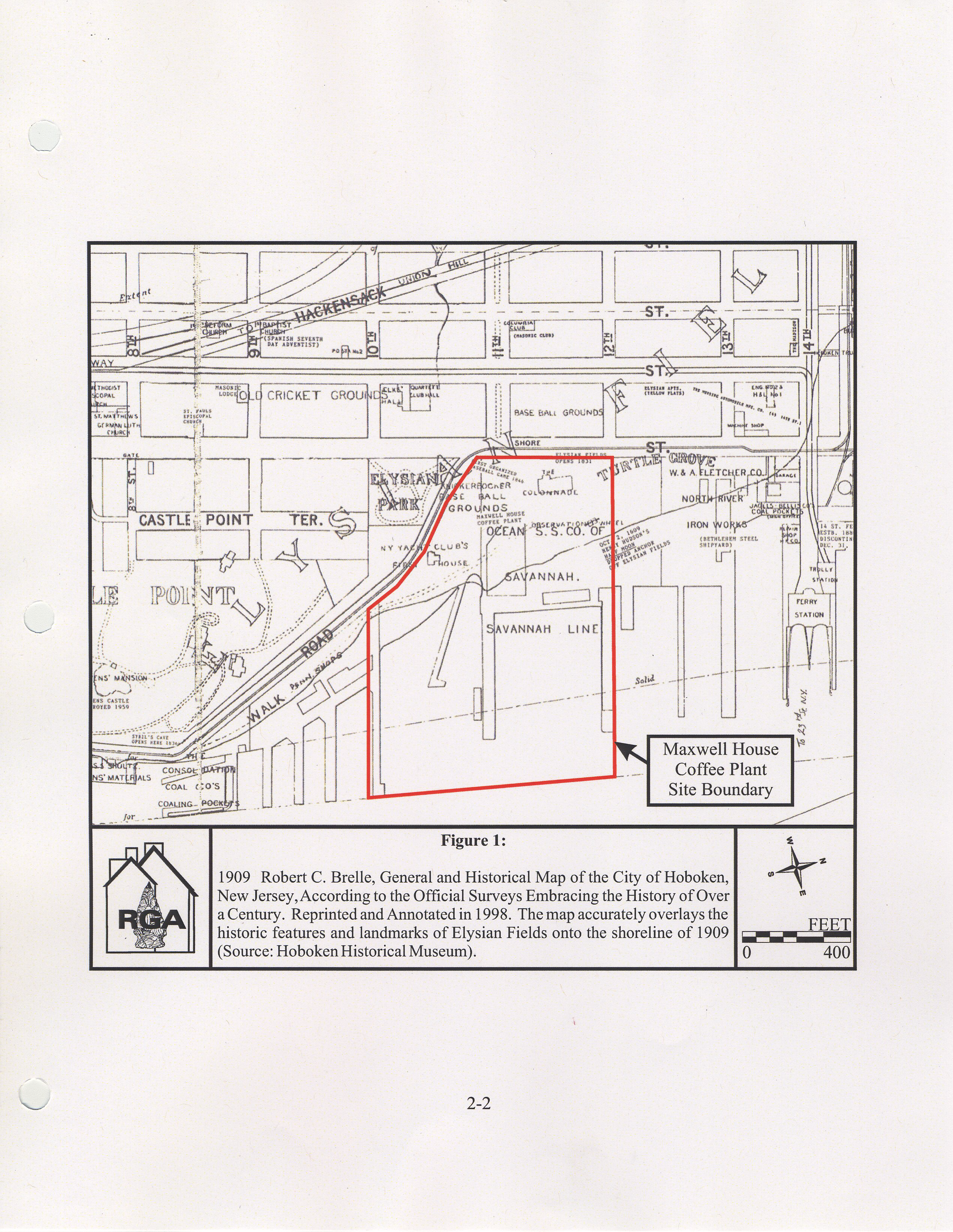
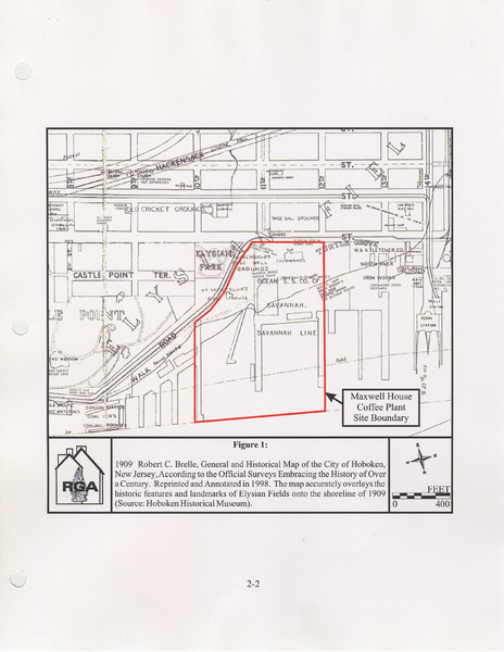
1909 Robert C. Brelle, General and Historical Map of the City of Hoboken, New Jersey, According to the Official Surveys Embracing the History of Over a Century. The map accurately overlays the historic features and landmarks of Elysian Fields onto the shoreline of 1909. (Source: Hoboken Historical Museum)
File history
Click on a date/time to view the file as it appeared at that time.
| Date/Time | Thumbnail | Dimensions | User | Comment | |
|---|---|---|---|---|---|
| current | 13:35, 10 July 2022 | | 2,541 × 3,285 (14.04 MB) | GeneD (talk | contribs) | 1909 Robert C. Brelle, General and Historical Map of the City of Hoboken, New Jersey, According to the Official Surveys Embracing the History of Over a Century. The map accurately overlays the historic features and landmarks of Elysian Fields onto the shoreline of 1909. (Source: Hoboken Historical Museum) |
You cannot overwrite this file.
File usage
The following page uses this file: